THE PLAN
|
|
Guiding Principles
We believe in...
- High quality design of the built environment - public and private architecture, streetscapes, corridors, gateways, and edges - that distinguishes the City.
- Strong neighborhoods with distinct identities and amenities within walkable distances.
- A connected greenway system that links waterways and environmental corridors as well as reaches into neighborhoods.
- A strong city center with increased intensity, mix of uses, and a vibrant and active public realm.
- Better utilization of vacant structures and land - through infill and redevelopment - that is well-served by infrastructure and adjacent to developed land.
- Greater intensity of development at strategic locations that creates a mix of uses and a critical mass required for a vibrant community.
- Planning together for our future populations.
LAND USE ELEMENT DOCUMENTS
The land use element is one of the nine elements of Columbia Compass: Envision 2036.
The land use element is one of the nine elements of Columbia Compass: Envision 2036.
|
|
LAND USE CHAPTER (PDF)
The land use chapter includes a discussion of the above guiding principles; a brief synopsis of existing conditions; an overview of critical components; future land use maps; and a number of recommendations for the next ten years, as well as supporting case studies. Please note that the above is large file and may take longer to load than the other chapter drafts. If you would like to view the chapter in smaller portions, you may do so using the links below.
|
|
|
APPENDIX F: LAND USE EXISTING CONDITIONS REPORT (PDF)
A detailed existing conditions report was developed during the research phase of the plan, and a synopsis of this report is also included within the land use chapter. |
|
FUTURE LAND USE MAPS
The land use element establishes development types (also referred to as future land use classifications) that share similar characteristics of function, form, and land use. You can view the plan maps on the City's interactive GIS public information viewer. |
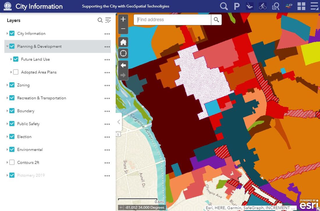
Once in the map, you'll need to select "Planning & Development" and "Future Land Use" in the drop down menu on the left. If you click on the color-coded future land use classification, you'll be able to click on a link to learn more about that future land use classification.
|
|
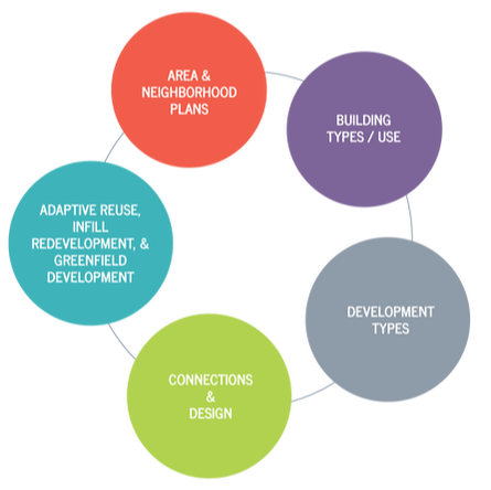
LAND USE CRITICAL COMPONENTS
|
The critical components set forth the underlying structure for the land use element, and the future land use maps apply these components spatially. Development types are applied citywide in a manner which reflects the community vision and an emphasis on creating the mix of uses appropriate to a specific neighborhood or corridor.
|
CONNECTIONS & DESIGN
The following slideshow of illustrative maps helps identify desirable opportunities for connections and design throughout the City. A discussion of the opportunities and recommendations relating to each of these maps can be found in the Connections and Design section of the Land Use chapter. Click on each image to view the image full screen.
The following slideshow of illustrative maps helps identify desirable opportunities for connections and design throughout the City. A discussion of the opportunities and recommendations relating to each of these maps can be found in the Connections and Design section of the Land Use chapter. Click on each image to view the image full screen.